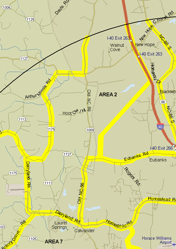
2. Old 86 area. Bounded on north by count circle, on east by I-40 from count circle to one mile south of New Hope Ch Rd, then line southwest and south to 0.6 mile west of intersection of Eubanks and Rogers Rd., then Eubanks west to Old 86, Old 86 south to Calvander, on south by Dairyland Rd from Calvander to Albert Rd. (1179), on west by Albert Rd., Union Grove Church Rd. (1179) from Albert Rd. to Arthur Minnis Rd. (1113), Arthur Minnis to Old 86 (1009), and Old 86 north to the count circle. Count both sides of Old 86, Dairyland, and Eubanks Rds. Do not count Albert, Union Grove Church, or Arthur Minnis Rds. or the Duke FACE site, which is covered in area 3. Includes all of Homer Ruffin Road and Mountain Creek Road and offshoots. Notes: This area includes part of the Blackwood Division of Duke Forest which has nice forested hiking trails.
Revised 31 December 2008 cwcook@duke.edu