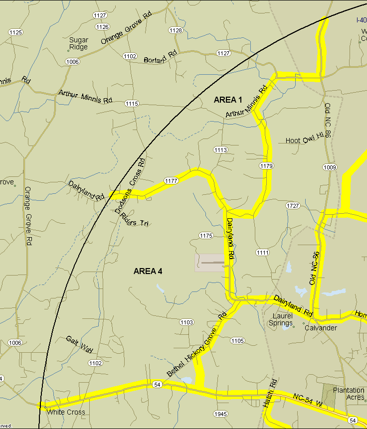
1. Maple View Farm area. Bounded on northwest by count circle, on south by Dairyland Rd. from count circle to Albert Rd. (1179), then Albert Rd. to Union Grove Church Rd. (1179), on east by Union Grove Church Rd. from Albert Rd. to Arthur Minnis Rd. (1113), Arthur Minnis to Old 86 (1009), and Old 86 north to the count circle. Count both sides of all boundary roads except count neither side of Old 86. Notes: Maple View Farm is high priority in Chapel Hill circle because it is the only area with extensive open fields. Target species include: American Pipit, Northern Bobwhite, Savannah Sparrow, Grasshopper Sparrow, Eastern Meadowlark, Bobolink.
4. Dodson's Crossroads area. Bounded on north by Dairyland Rd., on east by Dairyland and Bethel-Hickory Grove Ch. Rd., on south by NC 54, on west by count circle. Count the north side of NC 54 and both sides of Bethel-Hickory Grove Ch. Rd., but do not count Dairyland Road. Notes: Includes the American Stone quarry and pond. The pond rarely has anything on it, but had a Horned Grebe in 2008. The quarry is a suspected nesting area for Common Raven, but so far no birder has sought permission to check.
Revised 31 December 2008 cwcook@duke.edu