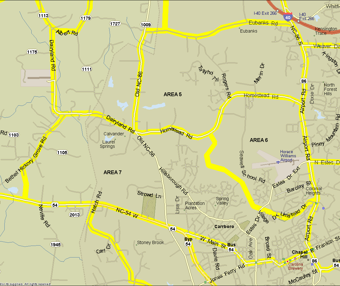
5. Lake Hogan Farm area. Bounded on north by Eubanks Rd, on west by old NC 86, on south by Homestead Rd., on east by NC 86. North side of Homestead Road (SR 1777) from NC 86 to Lake Hogan Farm Rd. Includes Lake Hogan Farm development, Rogers Rd. (1729) and offshoots; Southern Railway line from Homestead Rd. to Eubanks Rd. Excludes Eubanks Rd., Old 86, and landfill. Notes: Hogan's Farm, a dairy, was formerly a fantastic birding spot. The area is highly developed now, but the lake is still worth checking. A new area that may be worth checking out: a greenway extending south from Morris Grove Elementary along Jones Creek, which may be connected to the future Twin Creeks (Moniese Nomp) Park. The greenway connects to Lake Hogan Farm Road on the south and Tallyho Trail on the east.
6. Bolin Creek area. West side of NC 86 (Airport Rd.) from Homestead to Bolin Cr. Walk Bolin Cr. (both sides) back to Homestead. South side of Homestead between Bolin Cr. and NC 86. Notes:
7. Carrboro area. Bounded on south by Business 54 (Franklin/Main Sts.) from Columbia St. to SR 1104 (Bethel-Hickory Grove Ch. Rd.); north by SR 1104 from 54 to Calvander, then Homestead Rd. from Calvander to Bolin Creek, then Bolin Creek; east by Airport Rd. from Bolin Creek to Franklin St. Does not count either side of Bolin Creek, Bethel-Hickory Grove Church Rd., or Dairyland Rd. Notes:
Revised 29 Dec 2020 cwcook@duke.edu